Best Walks in Wicklow for Beginners
County Wicklow has walks for every level — and these eight easy routes are the perfect place to start, whether you are new to hillwalking, returning after a break, or simply after a good day out in one of Ireland's finest counties.
I take guests from Madeline's who have never walked a mountain in their lives out on the Railway Walk at Tinahely. Flat, forested, 8 km return, almost impossible to get lost on. Every single one of them books a return trip to Wicklow. That is what a good first walk does — it turns a nervous beginner into someone who starts browsing the Wicklow Way.
Wicklow is rightly famous for the dramatic stuff — the Spinc ridge, Lugnaquilla, the high sections of the Wicklow Way. But the county has an equally fine collection of easy, well-surfaced, low-level walks that any reasonably fit person can enjoy without specialist gear, mountain experience, or an early start. These eight walks are the pick for beginners: clearly marked, rewarding, and forgiving of imperfect footwear and uncertain weather.
Each entry gives you the distance, time, elevation gain, difficulty, why it works for beginners, one honest warning, where to park, and where to eat after. No vague positivity — just what you actually need to decide.
1. Railway Walk, Tinahely
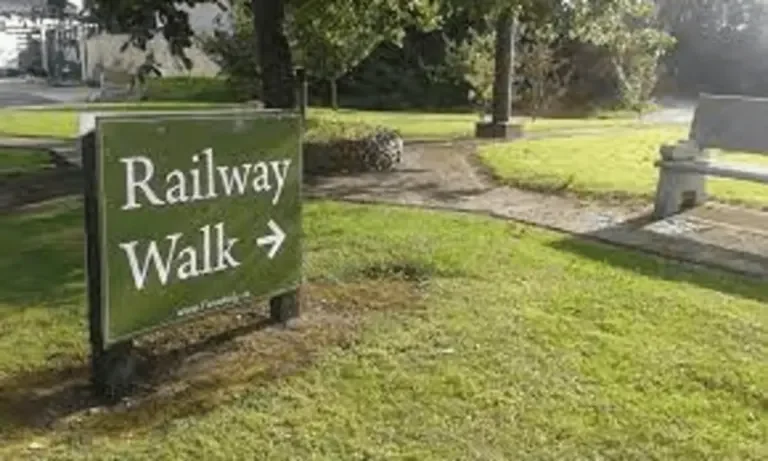
The Railway Walk follows the trackbed of the old Shillelagh branch line, a narrow-gauge railway that served south Wicklow from 1904 until 1944. It is entirely flat — it was a railway, after all — and the crushed stone surface is excellent year-round. The walk passes through farmland, mature hedgerows, and cuttings with embankment walls that are covered in wildflowers in late spring.
Why it works for beginners: No navigation required, no hills, no technical ground. The surface is wide enough for a buggy. You can turn back at any point. It is hard to have a bad experience on this walk.
Parking: Tinahely Town Square — free car park in the village centre, 5 minutes' walk from the start.
After the walk: D'Lish Coffee Shop in Tinahely village square does good coffee and food. If you are staying the night, Madeline's Accommodation is 50 metres from the car park.
Full route details on the Railway Walk page →
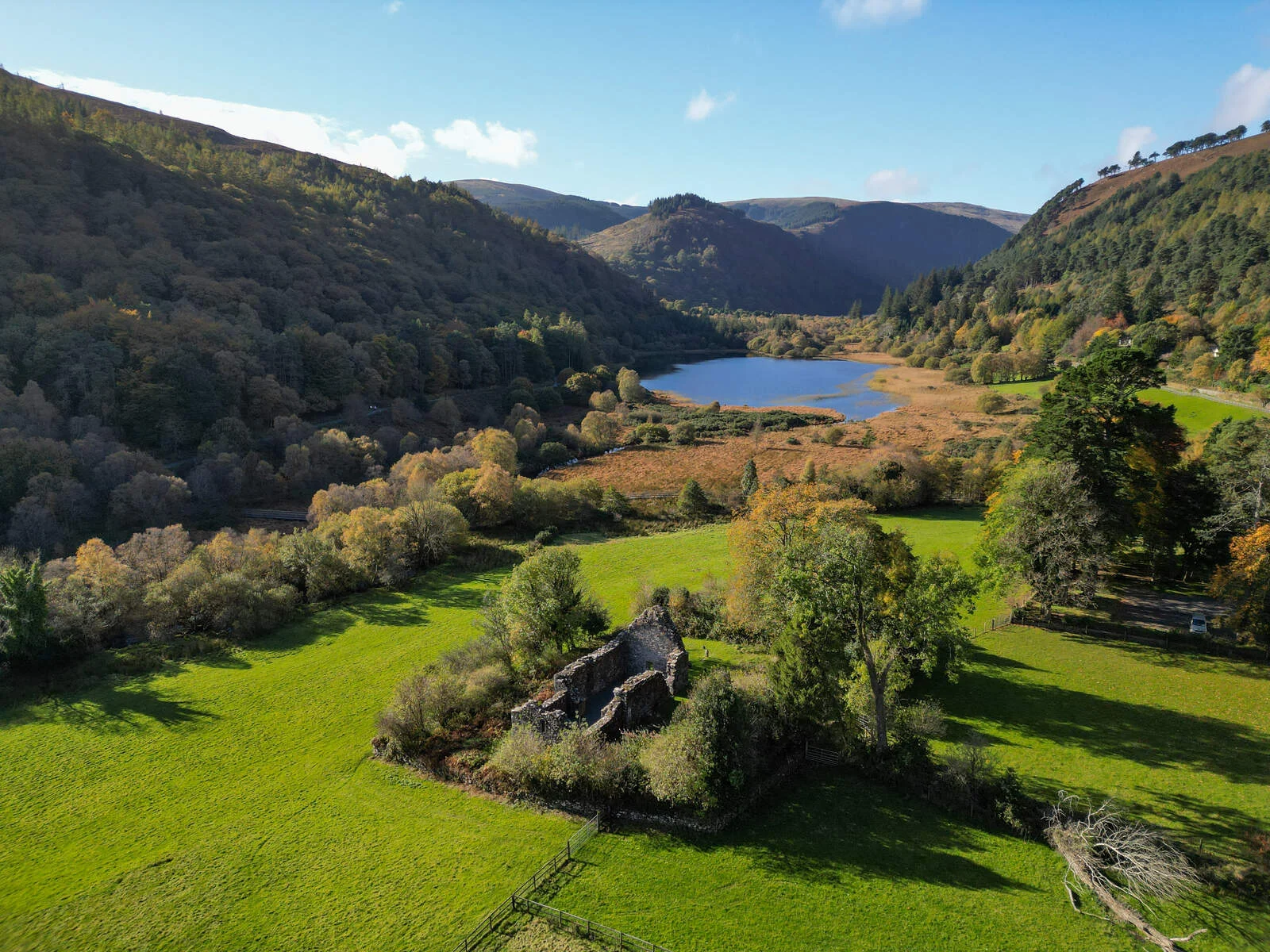
2. Glendalough Green Road
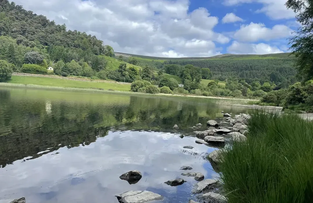
The Green Road is the old valley-floor track through Glendalough, running from the visitor centre past the Round Tower and monastic enclosure, along the Lower Lake, and all the way to the Upper Lake at the head of the valley. The surface is broad and well-compacted. The Round Tower is one of the best-preserved examples in Ireland, standing 30 metres high, and the two lakes sit between steep forested valley walls that rise sharply on both sides.
Why it works for beginners: The route is essentially one track — you go in, you come back. The historical interest keeps the walk engaging without needing any climbing. Glendalough is the single best introduction to central Wicklow for a first-time visitor.
Parking: Glendalough main car park (paid) or Upper Lake car park (also paid). The visitor centre is at the main car park end.
After the walk: The Glendalough Hotel has a bar and restaurant at the valley entrance. Lynham's pub in Laragh village, a kilometre from the car park, is a traditional village pub with good food. See our food and drink guide for more options around Glendalough.
The Green Road is also part of the Wicklow Way — see the full route →
3. Powerscourt Waterfall Walk
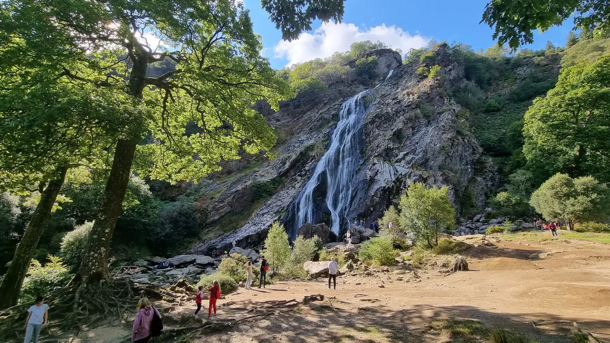
Ireland's highest waterfall (121 metres) at the end of a short walk through mature woodland. The estate grounds are well-maintained and the path to the waterfall is clear from the car park. The waterfall itself drops over a granite outcrop into a wooded bowl — it is most impressive after rain, when the flow is heavy enough to create a mist that reaches the viewing area.
Why it works for beginners: The payoff is immediate and significant — you arrive, you see Ireland's highest waterfall, you feel it was worth it. The path is clear, the distance is short, and the woodland setting is sheltered in wind. A good choice for mixed-ability groups.
Parking: Powerscourt Waterfall car park, Enniskerry — within the estate grounds (entry fee applies). The estate is 5 km from Enniskerry village.
After the walk: Poppies Café in Enniskerry village is one of the best brunch stops in north Wicklow. The village itself is worth a short walk around. See our food and drink guide.
Full route details on the Powerscourt Waterfall walk page →
4. Devils Glen Loop
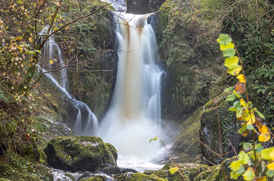
Devils Glen is a narrow forested gorge near Ashford in east Wicklow, carved by the Vartry River through a steep-sided valley. The waymarked loop takes you through mixed woodland, past a waterfall, and up to a viewpoint above the gorge before descending back to the car park. The forest is a Coillte managed estate with well-maintained paths and waymarkers throughout.
Why it works for beginners: The loop format means you do not retrace your steps, and the gorge itself is dramatic enough to hold interest throughout. The 120 m of ascent is spread over the loop and not concentrated in one steep climb — manageable for most people with reasonable fitness.
Parking: Coillte car park at Devils Glen, Ashford — free at time of writing.
After the walk: The Ashford Village Inn on the main street in Ashford does pub food. For something more substantial, Wicklow Town is 10 minutes south. See our food and drink guide.
Full route details on the Devils Glen walk page →
5. Bray to Greystones Cliff Walk
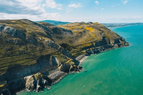
The cliff walk between Bray and Greystones is the most accessible walk in north Wicklow and one of the most frequently walked coastal routes in Ireland. The path follows the cliff edge above the Irish Sea for most of its length, with the Wicklow Mountains visible inland on clear days and the sea directly below on the other side. Bray Head marks the highest point, and from there the path descends gradually to Greystones harbour.
Why it works for beginners: Both ends are DART stations, so there is no car required and no retracing steps — take the DART one way, walk the other. The path is clear, the views are good, and finishing at Greystones harbour with a pint of Wicklow-brewed beer in front of you feels like a proper reward.
Parking: Bray DART station car park (paid, limited) or on-street in Bray town. The DART from Dublin Connolly to Bray takes approximately 35 minutes.
After the walk: Greystones harbour has several good options — the Hungry Monk restaurant and The Burnaby pub are both within easy reach of the finish. See our food and drink guide.
Full route details on the Bray to Greystones walk page →
6. Great Sugar Loaf
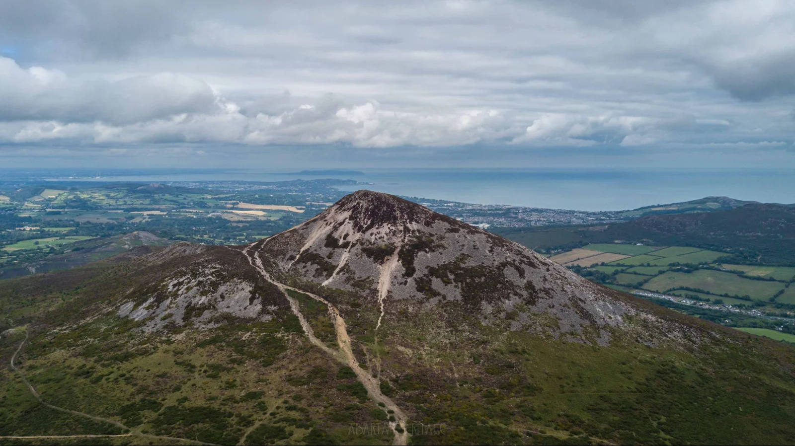
The Great Sugar Loaf (501 m) is one of Wicklow's most recognisable peaks — its symmetrical quartzite cone is visible from much of north Leinster on a clear day. The ascent follows a clear path from the car park on the Glen of the Downs side, climbing steeply over grass and loose quartzite to the summit. The views from the top take in Dublin Bay to the north, the Wicklow Mountains behind, and on clear days the Mourne Mountains in Northern Ireland.
Why it works for beginners: The Great Sugar Loaf is probably the easiest genuine mountain summit in Leinster. The path is clear, the distance is short, and the dramatic shape of the mountain makes the summit feel like a real achievement without requiring mountain experience or specialist gear.
Parking: Car park on the R755 at the Glen of the Downs, between Kilmacanogue and Delgany — free at time of writing.
After the walk: Avoca Kilmacanogue, 5 minutes north on the N11, is famous for its food hall, café, and shopping. Poppies in Enniskerry is 10 minutes away. See our food and drink guide.
Full route details on the Great Sugar Loaf walk page →
7. Glendalough Spinc
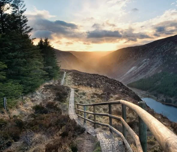
The Spinc loop is Wicklow's most photographed walk — a boardwalked ridge above the Upper Lake at Glendalough, with a descent through the old miners' village of Glenealo and back along the valley floor. The ridge section gives you an unobstructed view down into the valley with the two lakes spread out below, the Round Tower visible in the middle distance, and the forested valley walls on either side. It is the kind of view that makes people book a second trip to Wicklow.
Why it works for beginners: The boardwalk on the ridge section makes the most exposed terrain manageable in almost all weather conditions. The loop format is satisfying — the descent through the mining village adds historical interest. Moderately fit beginners who take their time will manage it without difficulty.
Parking: Glendalough Upper Lake car park (paid). The loop starts and ends here. The main Glendalough car park is a 2 km walk from the Upper Lake start.
After the walk: Lynham's pub in Laragh village is the obvious choice — well-worn walker-friendly pub with good food and Wicklow Brewery on tap. See our food and drink guide.
Full route details on the Glendalough Spinc walk page →
8. Camaderry Mountain
Camaderry (698 m) is the mountain directly above Glendalough to the north, rising steeply from the Upper Lake to an open moorland summit with exceptional views across the Wicklow Mountains. The ascent from the Upper Lake car park is direct and sustained — it does not meander. What you get at the top is the full Wicklow Mountain panorama, with the Glendalough valley far below and the high ground stretching north toward Dublin.
Why it is on this list: It is the most demanding walk here and I have included it because beginners who have worked through the other seven walks on this list are ready for it. Camaderry is the walk that transitions a beginner into a proper hillwalker. The navigation is straightforward in clear weather, the terrain is open, and the reward is proportionate to the effort.
Parking: Glendalough Upper Lake car park (paid). The ascent starts directly from the car park.
After the walk: Lynham's in Laragh or the Wicklow Heather restaurant near the Glendalough Hotel. Both are solid options after a long day on the hill. See our food and drink guide.
Full route details on the Camaderry walk page →
Tips for beginner walkers in Wicklow
- Weather changes quickly. Wicklow is one of the wettest counties in Leinster — always pack a light waterproof jacket even on sunny days. This is not optional advice.
- Start early at popular sites. Glendalough car parks fill by 10am on summer weekends. The Railway Walk and Bray to Greystones are rarely crowded.
- Download offline maps. Mobile signal is poor in several valley locations. Download your route to AllTrails or OS Maps before you leave home.
- Tell someone your plan. Even on easy walks, good practice means letting someone know where you are going and when you expect to be back.
- Leave no trace. Take all litter home, stay on marked paths, and keep dogs under control near livestock.
Planning a longer walk? See the full gear list for the Wicklow Way — what to pack, how heavy your bag should be, and a stage-by-stage breakdown of what each section demands.
The next step after these walks
Once you have done three or four of these, you are ready for Stage 1 of the Wicklow Way. It starts in Clonegal, finishes in Shillelagh, and takes about 5–6 hours. The terrain is gentle, the waymarking is reliable, and it gives you a taste of the full 132 km route without committing to the whole thing. From there, the full Wicklow Way is just a matter of stages.
Start planning the Wicklow Way at WalkWicklow.ie/wicklow-way/ →
Frequently Asked Questions
What is the easiest walk in Wicklow with a view?
The Glendalough Green Road gives you one of Wicklow's great valley views with almost no effort — flat, fully surfaced, with the Round Tower and the two lakes as your backdrop. The Great Sugar Loaf offers a more dramatic summit view in exchange for about 300 m of climb, which most people manage in under an hour. For a total beginner, start with the Green Road.
Are these walks suitable for children?
Yes — most of the eight walks are suitable for children, particularly the Railway Walk Tinahely (flat, hard surface, no hazards), the Glendalough Green Road, and the Powerscourt Waterfall Walk (short with a dramatic payoff). The Great Sugar Loaf and Camaderry involve significant climbing and loose ground and are better suited to confident older children.
Do I need hiking boots or are trainers okay for easy walks?
For the flattest walks — Railway Walk Tinahely, Glendalough Green Road, Bray to Greystones Cliff Walk — sturdy trainers with good grip are fine in dry weather. For any walk with uneven ground, and for all walks after rain, waterproof ankle boots are a significant improvement. Ireland's weather changes quickly, so waterproof boots are the better choice if you have them.
Are dogs allowed on Wicklow walks?
Many walks welcome dogs on leads, including the Railway Walk Tinahely, the Bray to Greystones Cliff Walk, and the Devils Glen Loop. Dogs are restricted in parts of the Wicklow Mountains National Park — check signage at the trailhead for Glendalough and surrounding areas before setting off.
Is parking free at Wicklow walks?
Parking charges apply at Glendalough (Wicklow Mountains National Park), Powerscourt Waterfall (entry fee to the grounds), and some other popular sites. The Railway Walk Tinahely, Bray to Greystones (Bray DART end), and Devils Glen all have free or low-cost parking at time of writing.
What month is best for a first Wicklow walk?
May, June, and September are the best months. May and June offer long days, reasonable temperatures, and bluebells in the woodland walks. September is often drier than August, the summer crowds at Glendalough have thinned, and early autumn colour is beginning in the uplands. Avoid January and February for first walks unless you are comfortable with short days and wet ground.
Can I do these walks solo?
Yes — all eight walks are suitable for solo walkers. The easier walks (Railway Walk, Glendalough Green Road, Bray to Greystones, Powerscourt Waterfall, Devils Glen) are well-used routes with other walkers present most days. For the Great Sugar Loaf, Glendalough Spinc, and Camaderry, download your route offline beforehand and tell someone your plan.
How do I get from Dublin to Wicklow walks without a car?
The DART from Dublin city centre reaches Bray in about 35 minutes — the Bray to Greystones Cliff Walk starts from the seafront at Bray DART station. For Glendalough and central Wicklow, St Kevin's Bus runs a dedicated Dublin–Glendalough service on weekends. For south Wicklow, Bus Éireann services stop in Tinahely. A car or organised tour is the most practical option for most walks.
Related walks and guides
Railway Walk, Tinahely
Flat, easy and ideal for all abilities — follows the old Shillelagh branch line through south Wicklow farmland.
The Complete Wicklow Way Packing List
What to pack for 7 days on the Wicklow Way — stage-by-stage gear notes and a final 30-second checklist.
Wicklow vs Kerry — Which to Walk First?
An honest comparison written by a Wicklow local who has walked both.